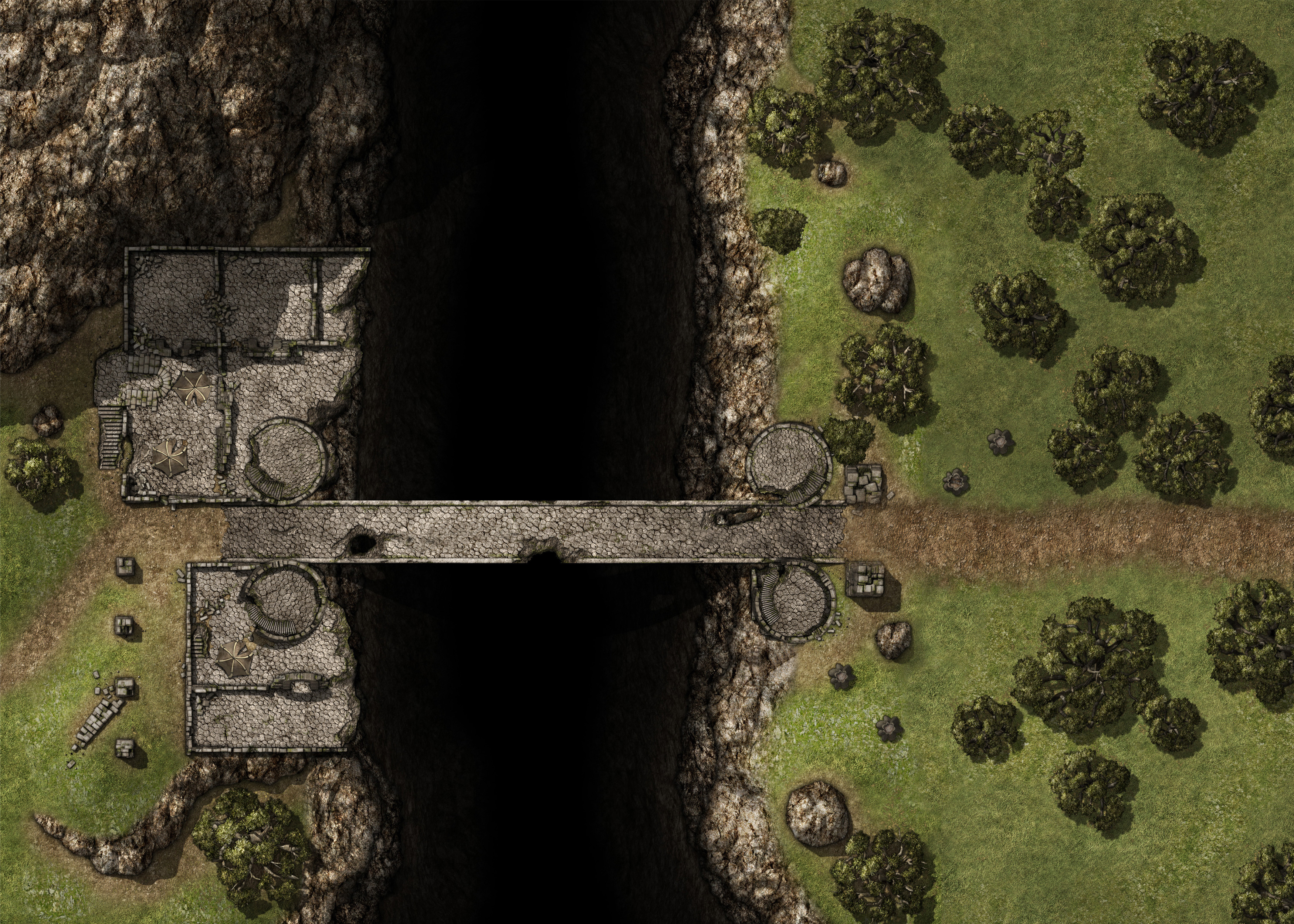
The ground has been rising for the last few miles, and finally the forest itself peters out. Ahead is a stretch of barren ground, about sixty feet wide, ending in a gorge. Roughly a hundred feet wide at its narrowest point, the gorge drops away precipitously to a fast-rushing stream far below. The ancient Dawn Way crosses the cleft on a bridge of stone.
Anchored at both ends to large stone towers with pentagonal roofs, the bridge seems sturdy despite its obvious age. It is, clearly, the only easy way to cross, since the gorge continues as far as the eye can see to the east and west. The four stone towers that anchor the bridge are each forty feet high. A narrow wooden stairway winds around each, leading up to an open-air watchpost at the top.