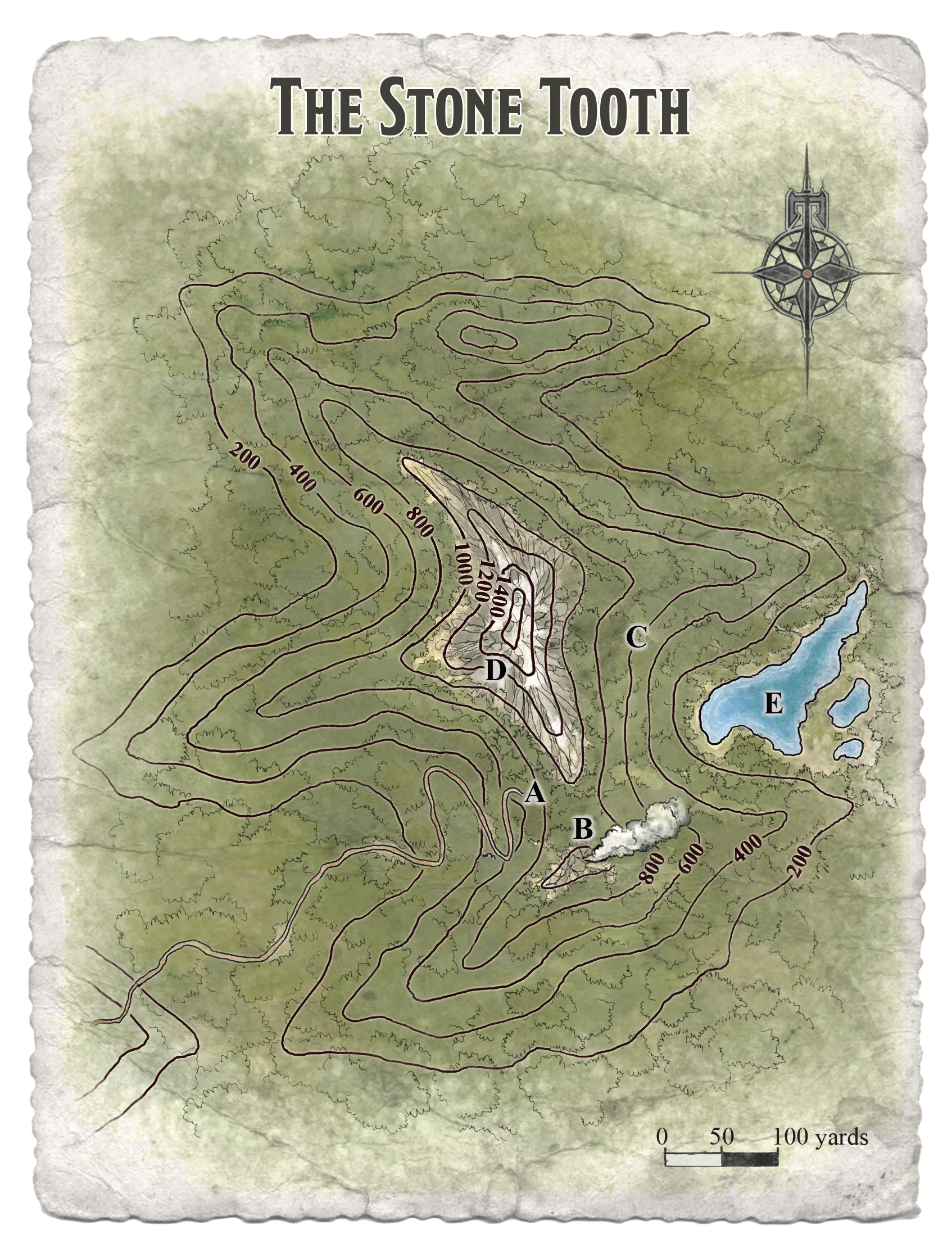
(A) The Mountain Door. This was the front entrance to the Glitterhame. The old dwarf-path leads from the Forest of Stone Tooth up to a bare shoulder of rock and then turned into a deep cleft in the hillside, where the first protection of Khundrukar was found: The Mountain Door.
(B) Chimney. A natural rock chimney lead down into the caverns below, and a thin stream of smoke could often be seen rising through it. The smoke spread out and was not easy to pinpoint in the rugged terrain.
(C) Orc Tunnel. On the other side of the Stone Tooth, a few hundred yards from the Mountain Door, the Orc army burrowed into the hillside to circumvent the dwarven defenses. The tunnel was still passable, but its entrance was choked with brush and debris.
(D) Hilltop. An hour or two of hard hiking could take a humanoid to the summit. The Stone Tooth was about 1,450 feet in height, towering over the neighboring hills by 500 feet or more. The last 100 feet or so was a sheer point of rock. The view is spectacular, but the hilltop was otherwise unremarkable.
(E) The Dark Mere. The eastern slopes of the Stone Tooth descended into a damp valley where water was trapped by the terrain. A dark tarn pooled under the hill's slopes, surrounded by numerous smaller lakes. A hidden drainage channel deep underwater connected to the subterranean Black Lake.