Durashan is the largest continental landmass on Talereth, stretching east from Alyndra for more than a thousand leagues. Its western coastlands hold fertile deltas, orchard belts, and caravan roads maintained by the Mercantile Guild, exporting grain, fruit, and rare alchemical herbs. The ancient woodlands of Lorethal begin here and stretch deep into the interior, where they meet high deserts, fossil-strewn steppes, and guarded mountain passes. To the east, the mighty Myrden River and its tributaries cut through jungle highlands and humid lowlands before spilling into a wide, shifting delta.
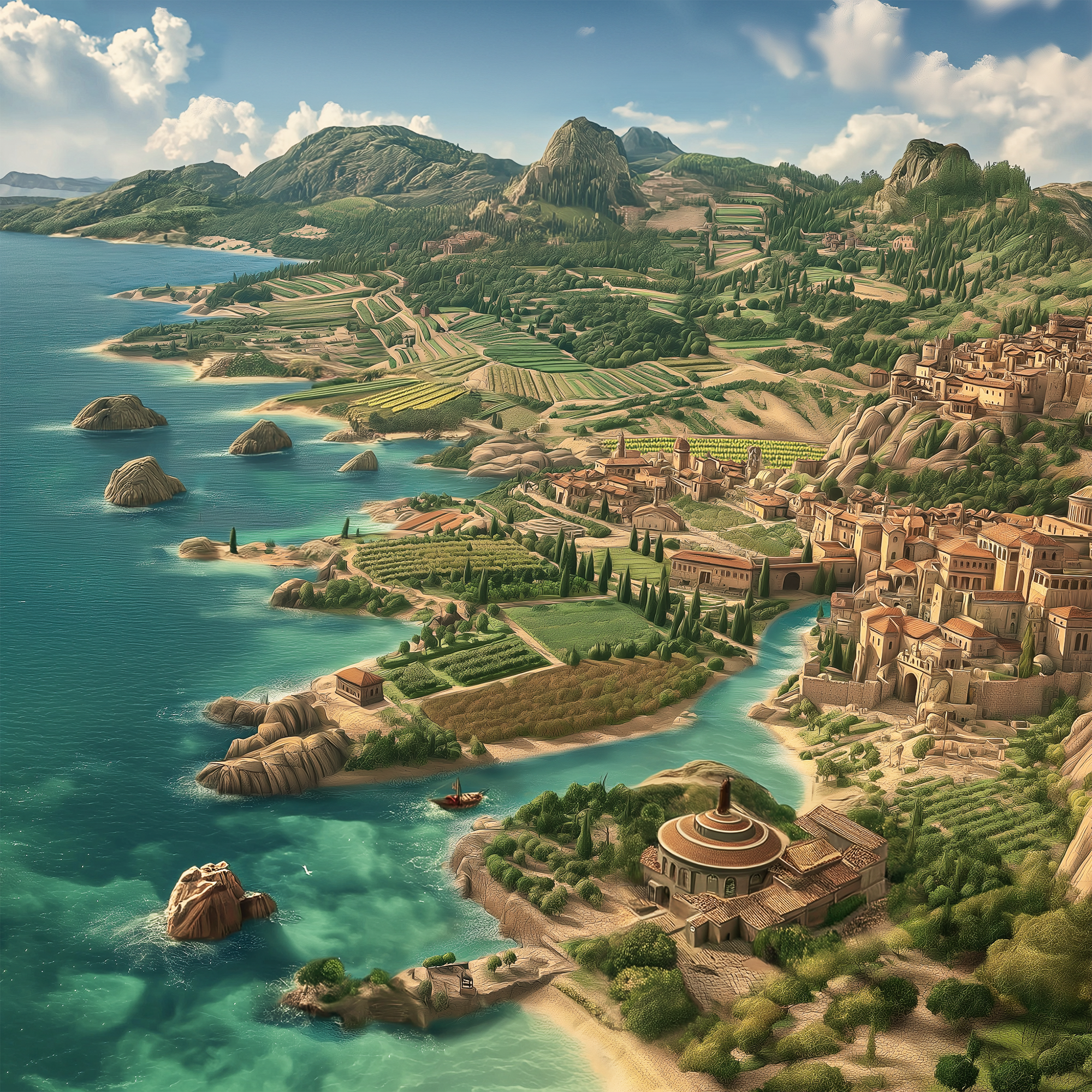
Western Coastlands
Known for: orchard exports, fortified ports, rural customs, rising tension.
As wide rivers empty into shallow bays, trade flows inland from ports like Brackenfall. Guild investment keeps farmland productive and towns orderly, with an abundance of temples serving both local spirits and newer faiths. Missionaries of the Radiant Mandate now share space with long-standing orchard rites and ancestor shrines, and tension between tradition and doctrine is growing.
Notable Western Locations
- Brackenfall: Fortified harbor city where Guild caravans, fishing fleets, and river barges converge. Beneath its markets lies a current of discreet dealings and faction politics.
- Sanctum of the Vigilant Flame: Inland spire south of Brackenfall, home to the Mandate’s largest western stronghold. Its beacon burns with holy fire, visible even from the coast.
- Valewick Orchards: Hills of fruit groves and herb farms tended by generations. Visitors are welcomed but watched.
- Duskwater Cross: Key caravan junction east of Brackenfall. Shrines line the road; weather shifts often set the tone for travel.
- Starleech Inlet: Black-sand cove north along the coast, avoided by sailors. Lights drift below the tide; locals urge silence if passing nearby.
- Hollowshade Thicket: Woodland inland from Starleech Inlet, known for medicinal mosses, echoing hollows, and vast root systems respected by druids.
Central Durashan
Known for: high deserts, caravan trade, ancient strongholds, contested frontiers.
The interior shifts from arid plateaus to green valleys along old riverbeds. Desert winds scour abandoned watchtowers, while oasis towns and fortified holds keep caravan routes alive. Much of the land remains dangerously wild, or held by fiercely independent rulers.
Notable Central Locations
- Sunreach Hold: High-desert crossroads serving as a luxury resort, trade hub, and hidden spelljammer port.
- Ironscar Range: Mountain barrier rich in rare ores. Mining camps cling to its lower slopes, while uncharted passes hold rumors of lost fortresses.
- Glasswater Oasis: A rare freshwater basin fed by underground springs. Beneath its clear surface, narrow fissures lead to flooded chambers from a long-buried outpost. Caravan leaders prize its water, but divers speak of strange carvings far below the light.
- Redspire Bluffs: Wind-carved cliffs of iron-rich stone that glow at sunrise. Caves in the upper faces serve as roosts for cloudwing drakes; lower ledges hide shrines tended by a reclusive sect.
- Marrow Steppe: Rolling grassland dotted with immense fossil beds. Many bones hold traces of ancient magic, drawing scholars and smugglers alike. Disturbing them risks rousing the steppe’s territorial spirits.
Eastern Jungles
Known for: vast river systems, humid lowlands, deep jungles, layered histories.
The east is dominated by the vast Myrden River and its tributaries, draining much of the continent into a wide delta. Thick forests and seasonal floods shape settlement patterns, with river travel often faster than overland routes. Travellers may pass ruined keeps from older ages or pause in quiet river villages where old songs still carry.
Notable Eastern Locations
- Emerald Reach: An expanse of forested highlands, rich in rare hardwoods and medicinal plants. Few maps agree on its borders.
- Mistroot Canopy: Dense rainforest where the ground is shrouded in warm mist. Enormous banyan-like trees knit a living bridge above the haze, used by hunters and smugglers to travel unseen.
- Shattered Delta: The eastern mouth of the Myrden River splits into a maze of shifting channels and mudflats. Fisher-villages cling to stilted platforms, and stone markers warn of submerged ruins.
Yrrik System Field Atlas, Fourth Survey Edition